
Redux: Cold Enough to Pay Attention
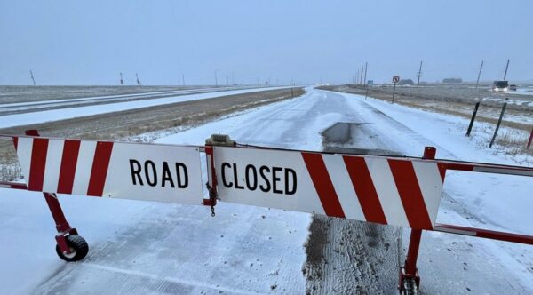
Well, the roads are not closed. not yet. But this is what it is looking like to the west of here as the sun rises on the East Coast. It is a mind-numbing 9F out there below the Conference Room windows on the 4th Floor of the Trillium. We liked this stock picture as a bit of a personal approach to what is to happen today.
Big colors. Careful words.
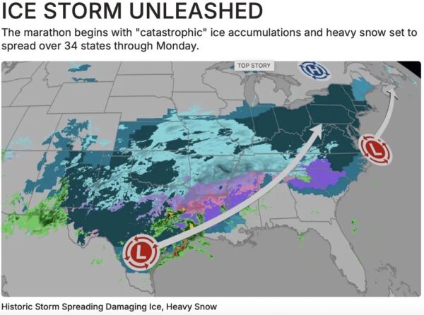
(The forecast advances east in dramatic shades, while the language stays deliberately modest).
This was the morning as depicted on the Weather Channel, the image and caption are their copyrighted material. It is used only to show what millions of us saw this morning in ther part where those in the Creative Section who slept near the window saw depicted as the light came up in the East.
The storm is all we have been talking about since Wednesday. It is still high cirrus clouds up there, and we saw the time Splash had written on the white board at the North End of the room: 1:45PM: Shadow on Parking Lot.
The news as we had heard it was that that sun still cast it’s shadow around the light towers, since the Weather Channel indicated there would be no light for a week or more since large chucks of ice would be falling from the sky in great chunks. This morning’s forecast is a little different. The map is moving in ominous colors but the words- not nearly as highly tinged- suggests we will start with flurries in about eight hours.
That drama is only a tease for what happens around midnight, when what they call as “heavy snow” will be in the process of dumping four to ten inches of wet stuff as it lightens toward morning and the atmosphere warms a bit, not to bring relief but rather rain that will crust stop the new snow and possibly freeze into a sheet two thousand miles long.
Or not, or course, but we are going with the possibility that this will be the most significant snow event in the last decade.
The DC area has seen some major snowstorms over the time the part of the District that was ungovernable was given back to Virginia in 1847. The largest snowfall accumulated to about 40 inches of white on the ground, or a little more than three feet in depth. The last one this ground of Boomer retirees, Millennials and Zoomers recall as a group was a decade ago. It was an unusual pain, as we remember, but it failed to set any records.
Having had four days of storm warnings, we have determined on a course of action that includes an excellent slow-cooked BBQ brisket from the Galley, and then an adult beverage count down to the first white flakes in the growing darkness.
If there is dawn tomorrow- and one is predicted- we will have the mystery unravel. The big moist mass from the Gulf of America could stall and dump more than three feet on the old NADA parking lot across from the front entrance to the Trillium.
Rocket had huddled with Melissa in one of those conferences they hold periodically. Rocket was hoping for three and a half feet, but Melissa had what could be the most realistic approach to things based on the family she had to raise against the backdrop of life on the Big River to the East.
“We won’t get as much as they predict, that is just the show business part of the weather. I say we will have six to eight inches of decent snow with rain starting after breakfast. That will leave an icy crust to clomp through on the way to the car, but we will not have to go anywhere since the liquor and grocery inventories have been sustained to March sometime.”
“Unless the icy rain continues through tomorrow afternoon.” Saod Rocket with a grump. “We asked her about the comparative temperatures down in the Gulf of America- we think that is what we are calling it- and he Arctic Circle.”
She says we should plan on a quiet afternoon with the new Ice Age starting at sunset in Tysons at 5:21PM.
We will be right here tomorrow even if the power isn’t!
Copyright 2026 Vic Socotra
www.vicsocotra.com
jayare303@aol.com
JAMES REDDIG
24 January 2026
Cold Enough to Pay Attention
Well,the roads are not closed. not yet. But this is what it is looking like to the west of here as the sun rises on the East Coast. It is a mind-numbing 9F out there below the Conference Room windows on the 4th Floor of the Trillium. We liked this stock picture as a bit of a personal approach to what is to happen today.
Big colors. Careful words.
(The forecast advances east in dramatic shades, while the language stays deliberately modest).
This was the morning as depicted on the Weather Channel, the image and caption are their copyrighted material. It is used only to show what millions of us saw this morning in ther part where those in the Creative Section who slept near the window saw depicted as the light came up in the East.
The storm is all we have been talking about since Wednesday. It is still high cirrus clouds up there, and we saw the time Splash had written on the white board at the North End of the room: 1:45PM: Shadow on Parking Lot.
The news as we had heard it was that that sun still cast it’s shadow around the light towers, since the Weather Channel indicated there would be no light for a week or more since large chucks of ice would be falling from the sky in great chunks. This morning’s forecast is a little different. The map is moving in ominous colors but the words- not nearly as highly tinged- suggests we will start with flurries in about eight hours.
That drama is only a tease for what happens around midnight, when what they call as “heavy snow” will be in the process of dumping four to ten inches of wet stuff as it lightens toward morning and the atmosphere warms a bit, not to bring relief but rather rain that will crust stop the new snow and possibly freeze into a sheet two thousand miles long.
Or not, or course, but we are going with the possibility that this will be the most significant snow event in the last decade.
The DC area has seen some major snowstorms over the time the part of the District that was ungovernable was given back to Virginia in 1847. The largest snowfall accumulated to about 40 inches of white on the ground, or a little more than three feet in depth. The last one this ground of Boomer retirees, Millennials and Zoomers recall as a group was a decade ago. It was an unusual pain, as we remember, but it failed to set any records.
Having had four days of storm warnings, we have determined on a course of action that includes an excellent slow-cooked BBQ brisket from the Galley, and then an adult beverage count down to the first white flakes in the growing darkness.
If there is dawn tomorrow- and one is predicted- we will have the mystery unravel. The big moist mass from the Gulf of America could stall and dump more than three feet on the old NADA parking lot across from the front entrance to the Trillium.
Rocket had huddled with Melissa in one of those conferences they hold periodically. Rocket was hoping for three and a half feet, but Melissa had what could be the most realistic approach to things based on the family she had to raise against the backdrop of life on the Big River to the East.
“We won’t get as much as they predict, that is just the show business part of the weather. I say we will have six to eight inches of decent snow with rain starting after breakfast. That will leave an icy crust to clomp through on the way to the car, but we will not have to go anywhere since the liquor and grocery inventories have been sustained to March sometime.”
“Unless the icy rain continues through tomorrow afternoon.” Saod Rocket with a grump. “We asked her about the comparative temperatures down in the Gulf of America- we think that is what we are calling it- and he Arctic Circle.”
She says we should plan on a quiet afternoon with the new Ice Age starting at sunset in Tysons at 5:21PM.
We will be right here tomorrow even if the power isn’t!
Copyright 2026 Vic Socotra
www.vicsocotra.com