
Over breakfast at Two Dog Flats Restaurant, Augustus reviewed for Rex and Marlow the next two days’ itinerary. It would be two easy segments of mostly straight roads through a park, nature preserves and then the Cascade Mountains and forests along Washington’s northern border with corner #2 being the final stop.
Two Dog Flats was lush grassland. These plains continued as the riders exited the park and entered once again the Blackfeet Indian Reservation.
They headed north on US 89. The Blackfeet people dominated these plains they called “The Backbone of the World” long before any European explorer entered the area now known as the Rocky Mountains. They believed that these mountains of glaciers were the home to spirits of the members of many area tribes. All warriors were called to journey this backbone on vision quests.
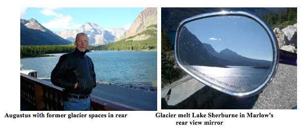
Consequently before heading west, the bikers viewed the park’s famous glaciers. They weren’t what the riders expected, being more like small, snow-covered piles of ice scattered on a few mountainsides. The park hadn’t hosted towering or impressive ice formations for many decades.
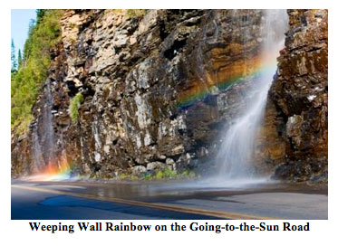
Afterwards, they bisected Glacier National Park and crossed the Continental Divide by taking the east-to-west Going-to-the-Sun Road. Based on what they saw, it should also be known as the Rainbow Highway due to the many rainbow waterfalls along or near the road. One special place was the Weeping Wall which bedazzled and refreshed tourists. The spray soothed the riders mountain-air parched lips.
As an added bonus, this was the first day in the last six where delays due to detours or road construction sites were both minimal and short in duration. Consequently, they arrived mid afternoon at Bonner’s Ferry, Idaho, on the Kootenai River.
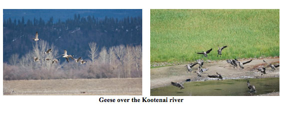
Their motel for the evening had a first-rate cocktail bar with 10+ foot high windows looking out onto the duck and goose filled river and sandbars.
Ensconced at the bar for several relaxing hours, they had a fabulous view of the evening’s goose rendezvous overhead the Kootenai river. It was a Keystone Cops comedy of errors.
There were many raggedly-looking, geese V-formations approaching the river at the same time. The adults in each formation’s lead adhered to an innate marshalling pattern altittude separation. Midair collisions were thus avoided.
Landings, however, were hilarius. Despite the mamas’ and papas’ honked encouragement, the kids had poor intervals from their sibling formation neighbors and, with beaks too high or too low, landing long, short and all over the place. Parental squawking at their juveniles poor performance resulted in many ruffled feathers. Thankfully things quieted down quickly after the sunset. These feathered nugget aviators were not yet ready to join the amphibious fleet air corps.
The next day found them stopped at several more, albeit brief, road construction stops along Washington route 31. At the last one they met a 40ish Native American gal. She looked and sounded like a shorter and somewhat svelter version of comedienne Rosanne Barr. For more than 25 minutes they stood in the speckled sunlight, occasionally test-kicking the newly chip sealed road surface and idly chatted about the area and her construction crew job.
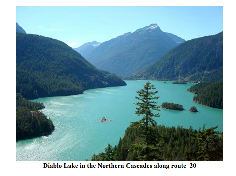
Most of the day was spent traversing Washington and its upper Cascade Mountain range along route 20. It was a scenic 300 mile two-lane road that was in good repair. Route 20 was once one of the state’s two east-west mainlines before the interstates came along. It was full of nice sweeping turns, steep-walled canyon valleys, mountaintop ridge rides, streams and lakes. Its emptiness’ pleasant balm was enhanced by the high 60s dry air temps.
These leather-clad, asphalt hobos wished this northern railroad ride would never end. Reluctantly, they bade the Cascade Highway a fare-thee-well as if it were an old lover, never expecting to see it again. For in this world they were bound to ramble.
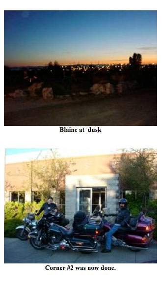
A tad north of 20’s western terminus was corner #2 in Blaine, Washington. The town is located along the 49th parallel and was the seaport that supplied almost all of timber that rebuilt San Francisco after the 1906 fire. The region’s timber supply was soon exhausted, so its inhabitants resorted to whiskey and rum running during prohibition as a primary occupation. When “happy days” returned to the country in the early 30s with the repeal of the Volstead Act, the town returned to its fishing industry roots. By the 70s the fisheries were tapped out. Since then, locals have survived on cannabis, gun and human trafficking. This corner city was Marlow’s kind of place. Just like his home town of Key West, Blaine had survived by guile and wit along with a little bit of larceny in its heart.
After more than 500 miles, they dined at a local Tex-Mex joint, Paso Del Norte Family Mexican Restaurant & Lounge. It served gargantuan sized portions of food and more than passable, cow watering trough-sized margaritas. They ended the day by sitting out front of their second story motel room and shooting the breeze while taking in Blaine’s sunset panorama.
Copyright © 2017 From My Isle Seat
www.vicsocotra.com