
Well, Gentle Readers, I had hoped to address you this morning with a tale of triumph, and the announcement that the Disctrict Stones Project was closed out, just as my physical abilities to do so are drifting away.
Sorry- just like everything else these days, I failed. I can tell you that I have a new sense of just what Major Andrew Ellicott and Benjamin Banneker confronted when the set out to clear a twenty-foot wide path around the boundary of the Federal District of Columbia, and place the forty marker stones at one mile intervals to designate the border of the capital of the new republic.
I am here to tell you that was a task I did not appreciate until I found myself in their world, away from the comforts of today.
The physical world is definitely not boring. In fact, for a gimp entering geezerhood, it can be downright terrifying.
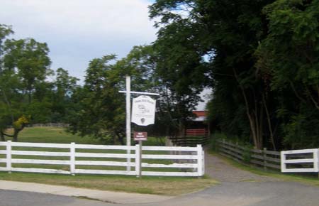
(Oxon Hill Farm. operated by the National Park Service).
I will stay away from politics this morning. It is making me more than a little nuts, this administration that so typifies the four “I’s”: inexperienced, inept, incompetent and illegal. History is going to have to sort that out- in fact, we will take a look at the alleged high-speed rail in California and a Russian alternative tomorrow.
But it was quite a shock to the system to find that what appeared to be a simple excursion of mild historical interest actually meant putting myself at risk in the wild, while still in the midst of the city.
I really wanted to close out the saga of the District Stones- in a moment of wild optimism, I even mused about hitting NE 5, the one in the deep woods near the intersection of Eastern and Kenilworth Aves, which is in a dicey neighborhood with no decent place to leave the car with any certainty it would be there on return. These things really require a expeditionary party, based purely on issues of personal safety. That is part of the attraction to the quest, since it is nothing that the average tourist would ever have the energy or insight to accomplish.
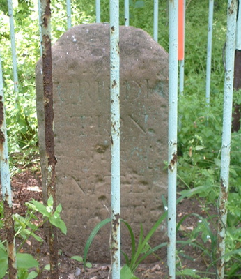
(This is the goal. We did not get there. The green cage was placed around the stone by the DAR in 1917 to protect them, and is the best “signature” to find the Stones, since some are truncated by wear or mischance almost to the level of the soil).
The description in the guide of how to reach SE 9, the last stop before the boundary jumps west across the Potomac, was quite vanilla:
“You can reach this stone on foot by following the partially-paved path that leads to Oxon Hill Farm from either D.C. Village Lane in Washington or the intersection of Oxon Run Drive and Audrey Lane in Maryland. Leave the path when it turns away from Oxon Cove; then follow the Oxon Cove shoreline to the base of Oxon Cove Bridge, where you must cross underneath I-295 to get to the Potomac River. From the endpoint of the large rocks that surround the base of the bridge, follow the Potomac shoreline about 1,000 feet southwest until you are just past due west of the Masonic Memorial (across the river) and the bridge is no longer visible behind you. If you are on a small sandy beach with car tires and debris, you are in the right place. The stone is 120 feet to the east in the forest at the foot of a hill. From the shoreline, it is just possible to make out the fence protecting the stone, although less so in spring and summer.”
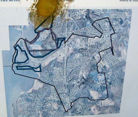
(Aerial photo of Oxon Hill Farm with the cover and interstate I-295 to the upper right).
My pal Argo agreed to meet up at the Oxon Hill Farm parking lot. It seemed safe, and a place we could leave a couple Yuppiemobiles without risk of having them stolen or trashed in what I thought would be a brief excursion.
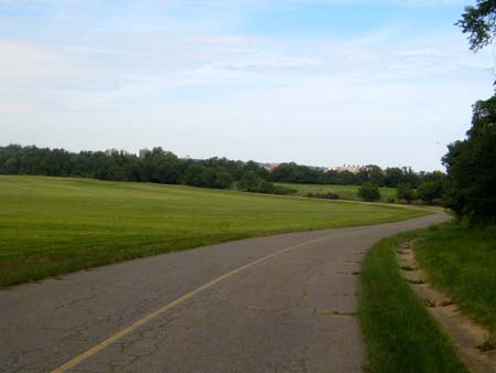
We started off incorrectly- we walked into the historic farm area, operated by the National Park Service. My leg was throbbing after just a couple hundred feet. And I can tell you whoever wrote the above directions should be dragged out and beaten severely, then shot.
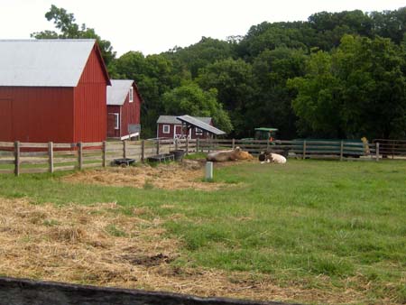
(Oxon Hill Farm is bucolic and delightful. It is also the wrong way to the Stone. The Park Service has a program to “Meet the Cows.” We did not participate.)
There is indeed a paved road down the bluff toward river level. It actually was quite pleasant once the grade eased- I can’t walk downslope as well as I would like, and the arthritis in the “good” leg has proceeded apace since the “bad” leg has been damaged, restricting my ability to walk normally.
Anyway, we saw a couple deer in a neatly mowed pasture and chattered away as we went, confident we would see the stone and be done with the outing shortly. Remember that part above about “Leave the path when it turns away from Oxon Cove; then follow the Oxon Cove shoreline to the base of Oxon Cove Bridge?”
(Pretty and pastoral. The Park Service keeps it neatly mowed, and the deer looked at us with only mild alarm. No hunters here. We were feeling pretty good about ourselves at this moment.)
It may be the rain we have had this year, or it may be that the author of the directions has never been there, or the reconstruction of the Oxon Cove Bridge has changed everything, but where the semi-pavement ended the jungle began.
There was a faint trail leading off along the bank of the cove, and we took it. The ground was semi-dry, and the periodic surge in the river level had distributed the waste of man- plastic jugs, water bottles, anything that floats- in a thicket of trash, overgrown and new. The flooding had undermined trees, which had fallen across the faint game trail, and branches and dead sticks poked and thrust as we gingerly moved, step by step, and clambering over tree-trunks. Some downed trees were concealed by the new growth. My gaze was locked down at my feet- if I fell and ripped out the repaired muscles, I was going to be screwed for sure. I was glad Argo was with me- if I got fucked up, at least someone could go for help.
It was that quick, passing out of civilization and into the wild. Argo took the lead, and I was grateful for his presence since I could only gingerly place my feet, and panicked as vines and tendrils threatened to snag my sneakers and pitch me headfirst into spear-like branches.
It was only a half mile, perhaps, crunching along the discarded bottles and detritus along the bank, where we could follow it, and across a couple little fetid muddy streamlets.
Bugs? Sure. Bugs to spare. I looked down at one of the periodic shoes that were scattered along the trail, never a pair, always singletons, and not one I could see with the remains of a tibia or fibula protruding.
At one challenging clamber over a deadfall, I saw the skull of a large animal. Not human. Deer, I assume. I did not poke at it.
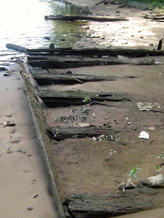
(Roof? Boat? Heavy lumber, whatever.)
It took more than an hour to cover the ground, approaching the roar of the interstate that surmounted the vertical stone retaining walls. There was evidence of previous structures- bricks scattered everywhere; a heavy wooden lattice- a roof? And even a section of footbridge, now stranded atop a jumble of driftwood.
We made it up a steep bank to the base of the wall of the bridge.
If there had ever been a path here, it was covered with random large stones to prevent erosion. There was no going forward to the aperture that would permit us to get under the freeway, and there the forward motion ceased.
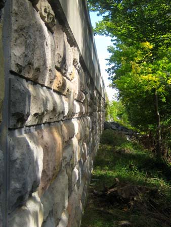
(The castle wall of I-295. It would have taken climbing gear to scale the heights to the break-down lane on the Northbound side of the highway.)
Argo might have been able to do it, but not me, the gimp. I hurt and was starting to get alarmed at the prospects of a fall and another trip to the hospital. Thank God I was not alone. Argo scouted north and south to see if there was any way to get up to the roadbed where civilization whizzed by our 18th century jungle, but there was no way without climbing gear. The road and bridge were as impregnable as a castle keep.
The stone was only a thousand feet away, but it was safe this day, protected by the rampart of the interstate and cloak of the river.
The only answer was to turn back. Disappointed, aching, and with the same obstacle course to traverse.
“Next time we do it by boat,” said Argo. I nodded in agreement. And then we clambered back down the steep slope, across the murky driftwood field on the mud, and back into the jungle.
I won’t bore you with the return clamber Argo went on ahead to fetch the car and left me quite disoriented in the jungle on growth- I had been looking down so intently to avoid falling that I had only a sketchy idea about keeping the water to my left. Eventually I met him as he drove back down the road, and he deposited me at the Panzer.
“Thanks, Argo. Some of the stones have taken me five attempts to find and document. Two to go. I will find a charter boat for the next assault. Expensive, but that will almost close out the quest.” Argo looked at me dubiously.
I drove home, legs quivering. I managed to make it to the pool and worked out the leg spasms with steady, gentle movement. Then I opened the bar early.
It is a daunting prospect to realize that I had better complete this adventure while I can.
Copyright 2013 Vic Socotra
www.vicsocotra.com
Twitter: @jayare303