
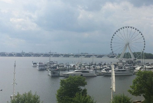
(The view from the Gaylord Hotel at National Harbor outlining our course north under the new Wilson Bridge).
Argo drove off that Spring morning and we both felt a sense of frustration. I motored back to the freeway and took the exit to National Harbor.
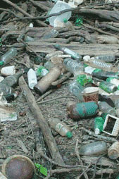
The Potomac is one big ass river as it opens up south of the Bluefields water treatment plant. It is broad and brown and probably unhealthy, and it is wild and tangled along the banks where trees and trash are piled willy-nilly, making land transit problematic.
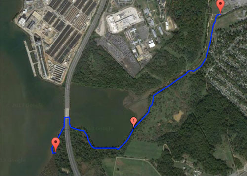
(The overland route to SE-9. We made it only as far as the east side of the highway bridge, and the path was impenetrable for me as a gimp. Argo might have been able to make it, as he is youthful and athletic and much better looking than I am).
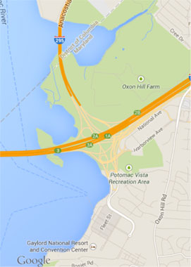
Argo and I had tried to find District Stone SE9 in the Spring. It looked simple enough from the overhead imagery- Oxon Hill Farm had relatively secure parking, and a path down the bluff to the forest. In the execution it was brutal- hard to imagine the wilderness that exists inside the limits of the District, fallen trees and clinging vines and uncertain footing. And all sorts of detritus washed down from the city in the periodic surges of rainfall that sweep all before it into the flow.
So, we decided the next attempt would be by boat, and there is a rental concession for kayaks that opened at National Harbor and Argo was in town, and it seemed like a natural- EZ in, EZ out.
Not so fast.
We negotiated the kayak rental from a surly fellow at the Gaylord National Resort and Convention center near the cool new Ferris Wheel with the view of the bold styling of the new Wilson Bridge. I remembered when we walked under the old one to see the first Stone, The South corner, a dozen years before, the rumbling above and the suspicion that something might fall down on us out of the darkness.
The rental agent gave us a gruff- and cursory- safety briefing and paddled to the north, battling the current and a strong quartering breeze.
There were no whitecaps but it was only just short of that. The vastness of the great river is quite remarkable when you are sitting a few inches deep in it, and the current and the flotsam and jetsam of the waterway is moving at a remarkable and impressive pace. The proud tower of the Masonic Temple in Alexandria pinpointed where we had to come abeam to what had been Fox Ferry Point, the terminus of the old nineteenth-century boat line from the foot of King Street to Maryland.
We got across the lagoon and under the Woodrow Wilson Bridge. We were not a team yet, with no preparation and no practice, and the current pushing inexorably south made progress difficult. I wondered about the incident of coronary in former athletes stroking hard as we tried to hug the coast to avoid the massive pressure of all that water pouring down to the sea.
We got disoriented- the low freeboard of the boat meant we were wet and our phones were useless in their little plastic zip bags, and the shore was a wild tangle of logs and drifted debris. We turned to starboard into a cove short of where we needed to be.
I sighed. We should have printed and laminated the imagery and the directions. But the shore was so tangled with limbs, branches and trash that there did not seem to be a way to land safely.
Or maybe I am a pussy. The Potomac is one big-ass powerful river, and I confess to being a little intimidated by its sheer strength.
We took advantage of the slack current in the cove, and watched a DC police boat watching us. Homeland Security is no laughing matter these days. Argo suggested we beach the boat and go ashore.
We would have been on the wrong side of the cove, and based on the terrain and the tangled mass of logs and trash, and was disoriented. It seemed like we would have had to circle the cove east and then north, climbing over the tangle of trash and broken trees. I said “I surrender. No more injuries and no more surgery.”
We backed around and paddled along the shore dodging logs and rocks. It was a lot easier going back down the majestic river with the current- and it was a nice outing even if a failure. I don’t do enough adventures these days but I have to be judicious about the amount of physical risk I am willing to take, since I have come to the realization that I am not only no longer bulletproof, but actually a frail freaking vessel.
We will figure out a way to see that stone. Looking at the map, it appears that we were almost there- but of course we were unprepared. If we had laminated the image we would have done it. I slapped myself aside the head. For God’s sale, I had been planning missions most of my active career, and now I prepared like a rank amateur.
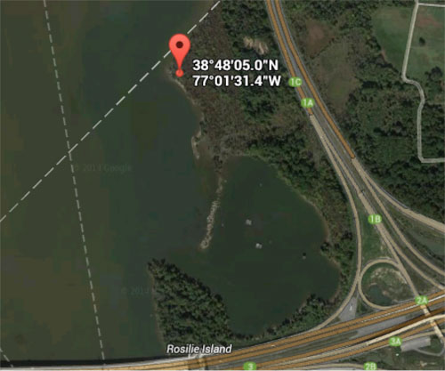
We turned into the cove just north of the point of Rosalie island. Oh well.
Next time we will just charter a boat with a motor. Maybe in the Spring.
Copyright 2016 Vic Socotra
www.vicsocotra.com
Twitter: @jayare303